
The Aka Pygmies : a threatened freedom.
Par teddy, jeudi 28 fûˋvrier 2008 à 18:05.
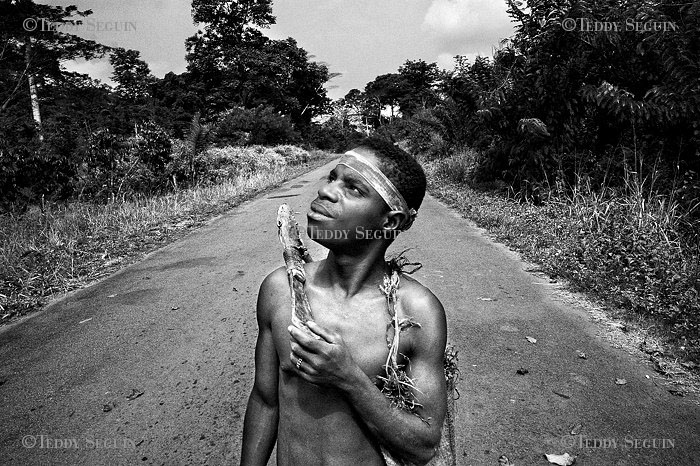
Granted as ãIntangible Cultural Heritageã by UNESCO, the Pygmies are considered the first inhabitants of Central Africa. In the past, they covered the whole rainforest located in the southwest of the country, searching for wild mushrooms, edible roots and game animals. Throughout their history, the pygmies have developed highly specific skills related to hunting, dancing, music and pharmacopoeia. In recent years, globalization has begun to catch up to them, making this nomadic people a more sedentary agricultural population settled around cities and villages. Still mostly unknown to most inhabitants of Central Africa, the Aka attempt to preserve a traditional way of life while modernizing and liberating themselves from the slavering grip of Bantou families. Caught between inequitable trade and pure exploitation working on villagersã plantations, these Aka Pygmies have also become the focus of all the monotheist proselytes.
Posté dans ENGLISH | aucun commentaire »